 |
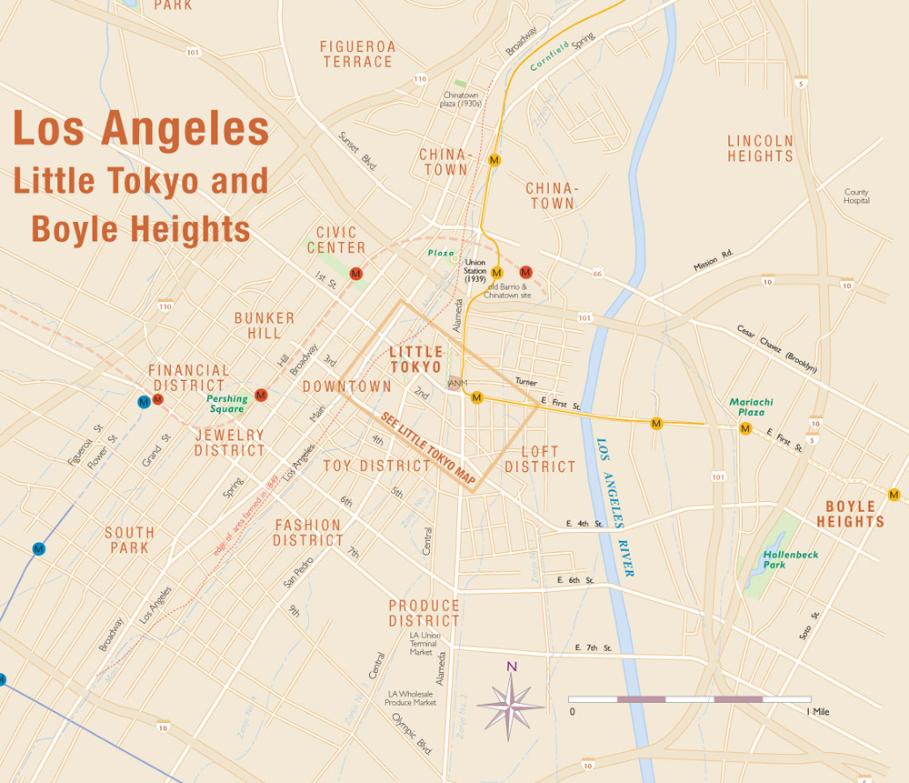
This map is
from http://japantownatlas.com/map-losangeles2.html. It
is a map of Downtown Los Angeles, Little Tokyo, and Boyle Heights. This
map not only provides some street names but train routes as well.
Although it
does not show Boyle Heights as descriptive as Little Tokyo or Downtown
Los
Angeles, it shows the proximity between the areas, illustrating how easy
it is to travel throughout Los Angeles. This map is interesting
because of the details it provides about public transportation. I think
that by
providing this information, this map encourages people to take public
transportation.
|
 |
This map is from http://www.studentgroups.ucla.edu/ivgcf/directions.html. It is a fairly simple map to UCLA with only 4 main streets identified. The map has UCLA as a landmark as well as the two main freeways surrounding the school. I think this map is interesting because it highlights the importance of the freeway system in Los Angeles. It assumes that everyone knows about the freeways because of the heavy car influenced culture we live in. Therefore, it emphasizes the freeways and uses them as a reference.
|

No comments:
Post a Comment